Northwest River Supplies (NRS), a supplier of equipment and apparel for water recreation, safety and onWater, creator of water recreation GPS navigation and mapping apps, are collaborating on tools and technology for river runners and anglers.
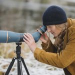
OnWater offers detailed information on miles of rivers, creeks and shorelines across the U.S. Satellite imagery provides GPS-specific points of interest and public versus private property boundaries along river corridors. Using a mobile device, users can track their current location and movement or calculate the distance in river miles to points of interest, including access points, boat ramps, campgrounds, river hazards, rapids, fly shops, and more. An integrated photo and journal feature allows users to use GPS-specific data to record activity.
NRS Chief Marketing Officer, Mark Deming, said, “As we work to make our sport more accessible, the onWater app opens the door for more people to float and fish safely, responsibly and enjoyably. This collaboration is a natural progression for us and gives us another way to bring our community together on the water.”
“With the exponential growth in fishing, more anglers are migrating to float fishing as a way to explore more water and seek solitude,” said onWater’s Co-Founder and CEO, Scott Carver. “Float angling, however, demands that anglers be armed with a greater level of information to navigate safely and confidently. Understanding flows, distances, conditions, hazards, and stream access laws become much more critical. The onWater app should become a permanent fixture in the NRS raft, just like a life vest.”
NRS and onWater are committed to giving back and contributing a portion of revenues to impact partners, supporting local conservation and advocacy campaigns, and to promoting responsible recreation practices.