The Town of Eagle, CO launched a new website, http://www.EagleOutside.com it says sets a new standard in recreation-based tourism. Located 30 miles west of Vail, Eagle is Colorado’s best kept secret. It’s quickly becoming an outdoor adventure destination for travelers in the know, and those looking to escape the crowds that often surround Colorado’s popular mountain towns.
EagleOutside.com is designed to sell Eagle’s recreational opportunities, businesses, festivals and events to visitors. What sets it apart is a comprehensive mapping system integrated with Google Maps API. This provides the user with easily accessible GPS data including campsites, parking, trailheads, mileage markers, intersections, fishing and rafting access points to name a few. All activities and nearby amenities are plotted in a user-friendly fashion on a single page.
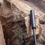
These GPS labels are further enhanced to create a unique photo navigation capability. Site designers embedded the labels into thousands of photos. A corresponding map pin marks each image’s location. Users simply click through any trail’s gallery to view the entire route. New visitors will use the detailed notes on intersections, water crossings and scenic viewpoints as a tool to preview terrain. All this information is delivered on an easy to navigate interface, and fast.
No detail is spared, and site designers are aware that there is nothing like the feel of a crisp map in your hands. Downloadable directions are also available on the site, and include everything a new visitor needs to enjoy the great outdoors in Eagle.
The fun doesn’t stop there. The town will follow-up with a mobile version complete with GPS navigation. Users will easily view any activity from their mobile device, and identify their exact location on a trail.
With over 100 miles of mountain biking and hiking in various levels of difficulty, Eagle has something for everyone and a lot of it. “When I talk with folks who have just ridden our trails for the first time, they’re always amazed by the distance and the diversity of the landscape,” says Stepanek. “The new website and mapping system will enhance the visitor experience by giving recreationalists a simple way to navigate our terrain.”